


What Is Convective Instability?
Convective instability is an atmospheric condition in which a lifted air parcel can become warmer or less dense than its surroundings and continue rising. It develops when temperature and moisture profiles allow buoyant acceleration after an initial lift. A useful measure is CAPE = integral g(Tv_parcel – Tv_env)/Tv_env dz, which estimates buoyant energy available to rising air.
In real weather, convective instability depends on surface heating, humidity, cooling aloft, wind shear, and lifting triggers such as fronts, terrain, or convergence zones. Once released, it can produce towering clouds, showers, thunderstorms, hail, or intense local downdrafts. It guides convective cloud triggering because timing matters when the atmosphere is close to releasing stored buoyant energy. Used in devices include radiosondes, Doppler radars, ceilometers, lightning detectors, microwave profilers, and forecast model systems.
The concept matters because convection moves heat, moisture, and momentum vertically through the atmosphere. It controls storm initiation, rainfall intensity, cloud depth, and severe-weather potential. Forecasters evaluate instability together with inhibition and wind shear, because a highly unstable atmosphere may remain quiet without a trigger.
Soundings and model profiles reveal instability by showing how parcel temperature changes with height compared with the surrounding air.
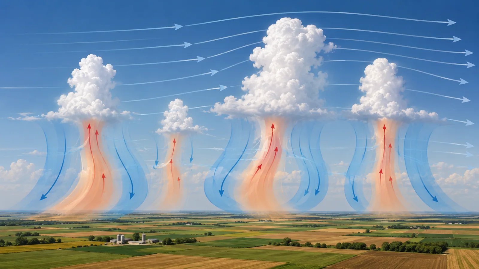
Example:
Afternoon heating over moist farmland can increase convective instability until small lifting along a boundary initiates thunderstorms.
Related Terms:
NoSuchDevice is a free archive of machines that do not exist yet but already have a shadow in physics. I research and write every entry alone, with no ads. Take a look around the archive, or help keep it free.