


What Is Tidal range?
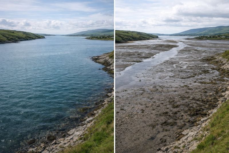
Tidal range is the vertical difference in water level between high tide and low tide at a given location. It represents stored gravitational potential energy in a coastal basin, so larger ranges can drive more useful hydraulic head through turbines or sluices. For barrage-style systems, the available energy is often estimated with E = 0.5 rho g A h^2, where h is the tidal height difference and A is basin area.
In practice, tidal range is small in the open ocean and much larger in estuaries, bays, and inlets where coastline geometry amplifies the tide. Local shape, seabed depth, and Tidal Resonance can raise the range dramatically, while the monthly cycle between spring tide and Neap Tide conditions shifts the usable head from one week to the next.
The concept matters because it sets both the energy yield and structural design basis for impoundment schemes. In tidal barrage resource assessment, engineers use range data to estimate turbine operating windows, sluice sizing, embankment loads, and expected output across the lunar month rather than at a single peak tide. That makes long records of range variation central to revenue modeling.
Example:
A tidal barrage site with a 12-metre range can store far more potential energy per cycle than a nearby estuary with only 4 metres of rise and fall.
Related Concepts:
- Hydraulic Head
- Spring Tide
- Basin Area
NoSuchDevice is a free archive of machines that do not exist yet but already have a shadow in physics. I research and write every entry alone, with no ads. Take a look around the archive, or help keep it free.