


What Is Urban heat island?
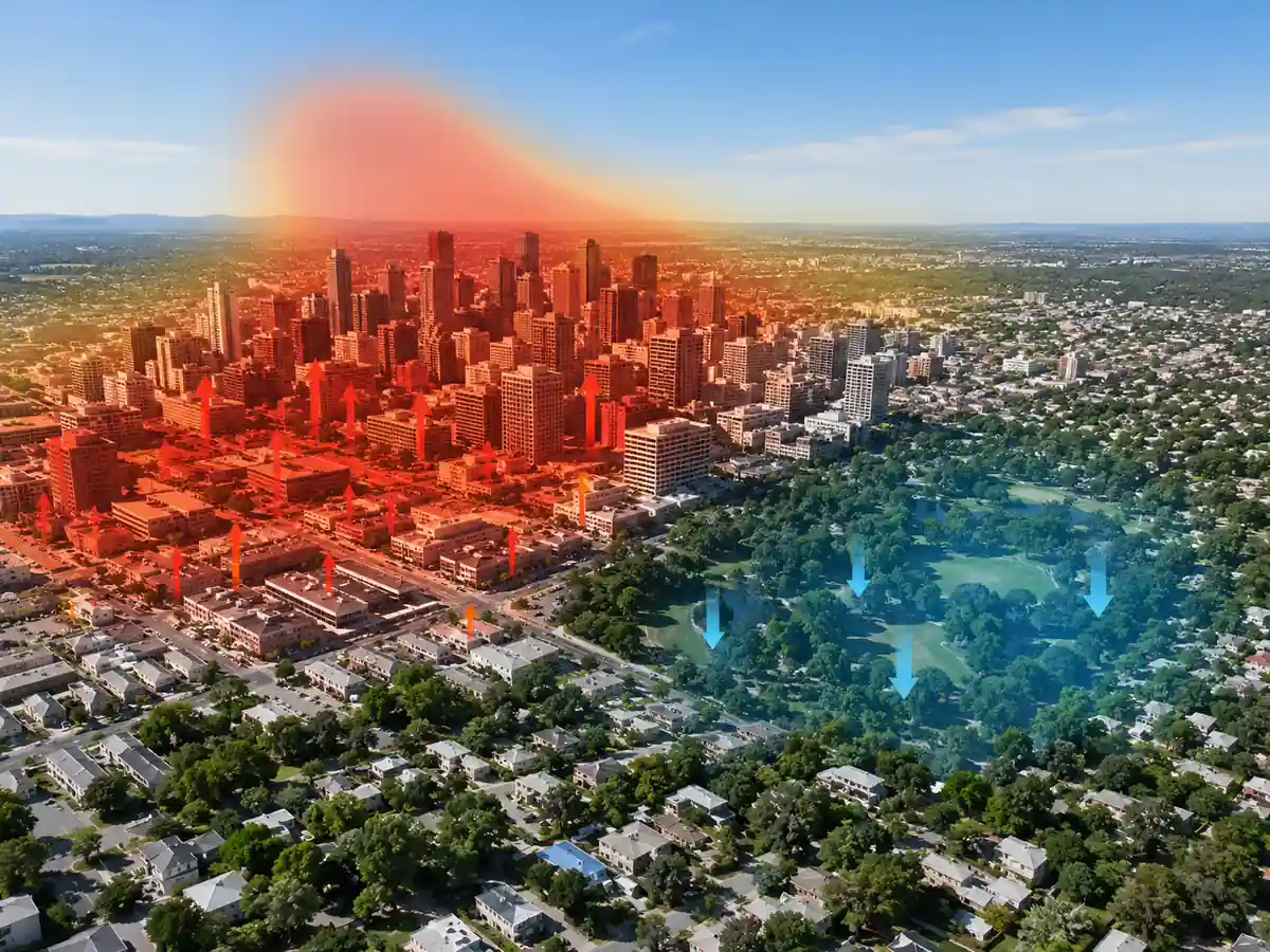
An urban heat island is the temperature increase that makes a built-up area warmer than nearby rural or less-developed land. It forms when dark surfaces, dense materials, reduced vegetation, waste heat, and street geometry store and trap thermal energy. A common measure is Delta T_UHI = T_urban – T_rural, comparing urban air or surface temperature with a reference area.
In real cities, heat islands vary by time of day, season, wind, humidity, building density, and surface material. Asphalt and concrete absorb solar radiation during the day and release it slowly at night, while limited evapotranspiration reduces cooling. In urban climate design, added canopy, shade, reflective surfaces, and ventilation corridors all change the local heat balance.
The concept matters because excess urban heat raises cooling demand, worsens air pollution chemistry, increases heat stress, and can raise mortality during heat waves. Used in devices include rooftop weather stations, thermal cameras, satellite radiometers, smart irrigation controllers, and urban climate sensor networks. Measuring the effect helps planners compare interventions that lower surface temperature, increase plant cover, or reduce stored heat in dense districts.
Example:
After sunset, a dense downtown street can remain several degrees warmer than a nearby park because masonry and pavement release stored daytime heat.
Related Terms:
- Evapotranspiration
- Albedo
- Solar Irradiance
NoSuchDevice is a free archive of machines that do not exist yet but already have a shadow in physics. I research and write every entry alone, with no ads. Take a look around the archive, or help keep it free.