


What Is Active remote sensing?
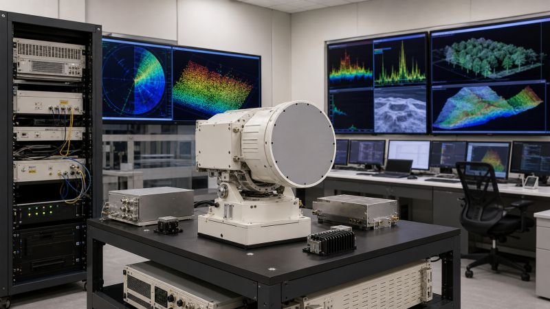
Active remote sensing measures a target by transmitting energy toward it and recording the returning signal. Because the instrument supplies its own illumination, it can operate day or night and often through haze or cloud. A common ranging relation is R = c * t / 2, where distance depends on round-trip travel time.
In real systems, the transmitted energy may be microwave pulses, laser light, or acoustic waves, depending on the medium and scale. This makes active sensing useful in all-weather Earth observation, topographic mapping, motion tracking, deformation measurement, and navigation in environments where passive imagery is limited.
The method matters because it gives engineers control over wavelength, timing, and pulse structure, which expands what can be measured from a distance. Used in devices include radar satellites, lidar scanners, altimeters, automotive ranging systems, bathymetric sensors, and industrial inspection tools that reconstruct shape, height, speed, or surface properties.
System performance depends on pulse bandwidth, power, antenna or optics size, target reflectivity, and signal processing quality. Designers balance resolution against coverage and energy use, then correct for noise, multipath, and atmospheric distortion so the measured return can be interpreted as reliable geometry or material information.
Example:
A radar satellite can image flooded terrain at night during cloud cover because it measures its own microwave return instead of waiting for sunlight.
Related Terms:
NoSuchDevice is a free archive of machines that do not exist yet but already have a shadow in physics. I research and write every entry alone, with no ads. Take a look around the archive, or help keep it free.