


What Is Lidar?
Lidar is an active sensing method that uses laser pulses to measure distance by timing how long light takes to travel to a target and back. The basic ranging relation is R = c * t / 2. By repeating that measurement rapidly across many directions, lidar builds a geometric description of a scene.
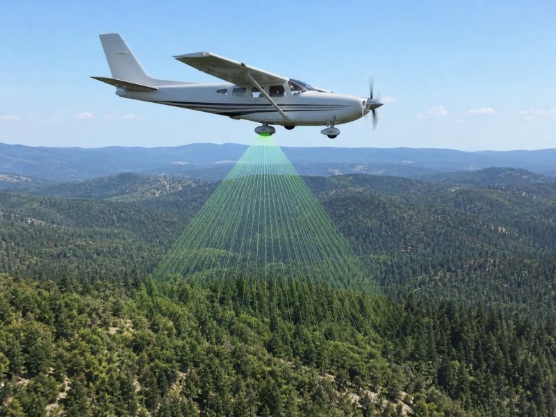
In real systems, lidar can be mounted on aircraft, drones, vehicles, tripods, or satellites and can measure terrain, structures, or vegetation with high spatial detail. It is widely used in three-dimensional terrain mapping, forestry, autonomous navigation, corridor surveying, archaeology, and industrial inspection.
The technique matters because it captures shape directly instead of inferring geometry only from brightness or color. Used in devices include topographic mappers, self-driving vehicle sensors, canopy-height survey systems, warehouse scanners, bathymetric instruments, and robotic perception platforms that need precise range information.
Point-cloud quality depends on pulse rate, scan pattern, wavelength, target reflectance, and position accuracy of the platform. Engineers also classify returns from canopy, buildings, and ground so the same raw observations can support elevation models, obstacle detection, biomass estimates, or volumetric measurements.
Example:
An airborne lidar survey can separate tree canopy returns from ground returns to estimate both forest height and the terrain hidden beneath it.
Related Terms:
NoSuchDevice is a free archive of machines that do not exist yet but already have a shadow in physics. I research and write every entry alone, with no ads. Take a look around the archive, or help keep it free.