


What Is Atmospheric correction?
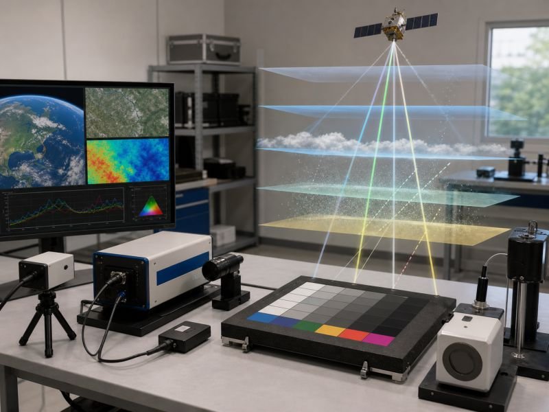
Atmospheric correction is the process of estimating and removing the effects of gases, aerosols, and scattering from remotely measured radiation so surface properties can be compared more accurately. A simplified relation is L_surface ~= (L_sensor – L_path) / T, where path radiance and transmission alter the recorded signal before it reaches the sensor.
In real workflows, the correction depends on wavelength, viewing angle, solar geometry, water vapor, and aerosol loading, because each factor changes how much radiation is absorbed or redirected. This step is central to satellite reflectance retrieval for vegetation studies, mineral mapping, water quality analysis, and change detection.
The method matters because measurements from different dates or sensors are difficult to compare if atmospheric contamination is left untreated. Used in devices include satellite processing pipelines, drone imaging systems, calibration spectrometers, sun photometers, and environmental data services that convert raw radiance into more physically interpretable surface products.
Engineers validate atmospheric correction with reference targets, field measurements, and radiative-transfer models rather than assuming one fixed adjustment works everywhere. The accuracy requirement becomes stricter when the goal is subtle trend detection, because even small atmospheric biases can resemble real vegetation, moisture, or temperature change.
Example:
Two satellite images of the same wetland can become comparable after atmospheric correction removes the extra haze contribution from one acquisition.
Related Terms:
NoSuchDevice is a free archive of machines that do not exist yet but already have a shadow in physics. I research and write every entry alone, with no ads. Take a look around the archive, or help keep it free.